Today I took lowlands and depressions commonly called lowlands to the workshop. I remind you that I draw borders roughly.
I highlight the most important items in bold in the description.
The areas marked with * are not quite lowlands, but they can be classified into them – usually plains lower than highlands.
Outline maps are from Wikipedia.
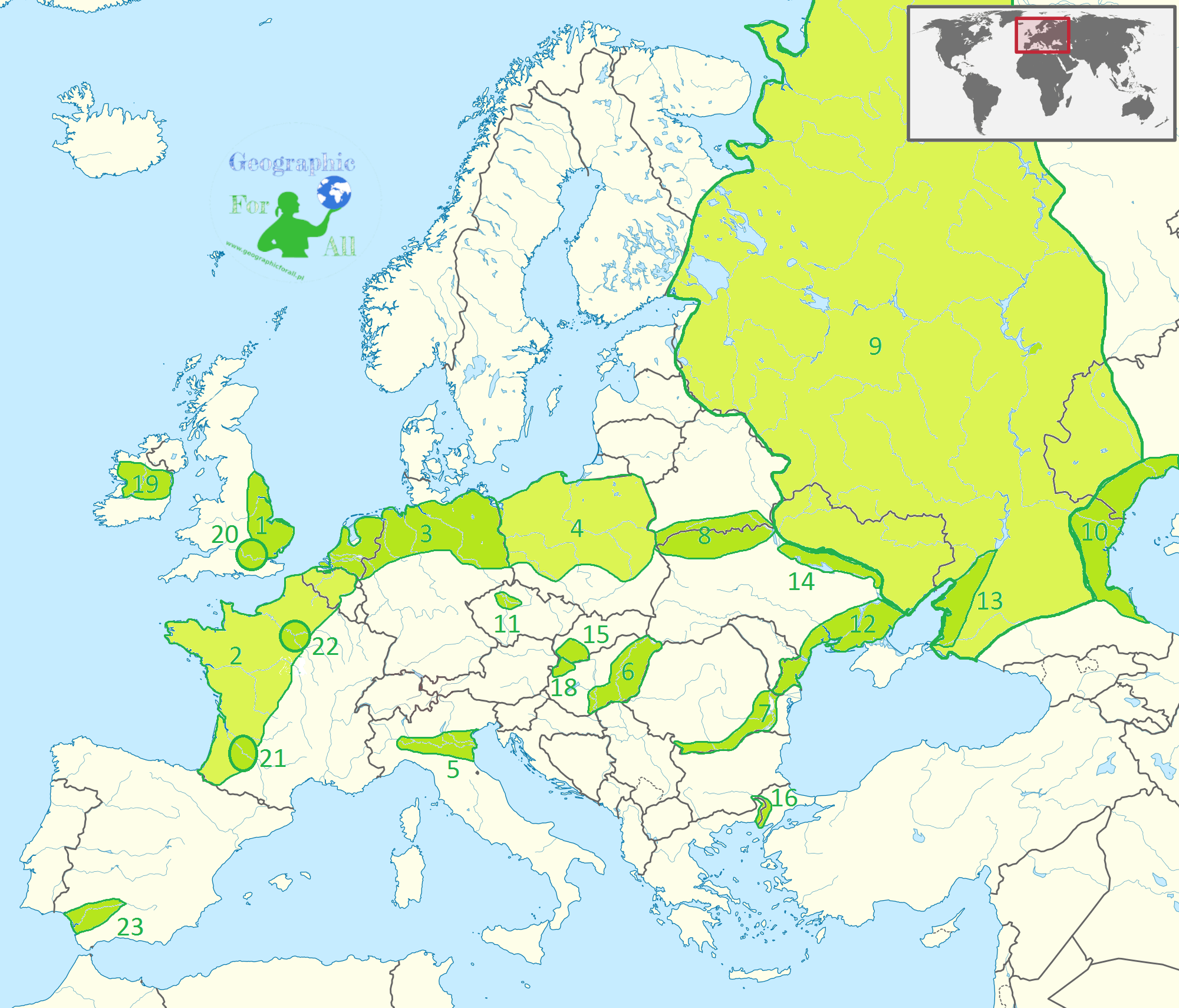
Europe
I used a slightly lighter shade just to make the map easier to read – there was no hidden purpose.
- English Plain
- French Plain
- German Plain
- Polish Plain
- Padan Plain / Po Valley
- Great Hungarian Plain
- Romanian Plain / Wallachian Plain
- Polesie
- East European Plain / Russian Plain / Sarmatic Plain
- Caspian Depression / Caspian Lowland
- Polabska Plain
- Black Sea Lowland
- Kuban Plain
- Dnieper Lowland
- Danubian Plain
- Thrace Plain
- Little Hungarian Plain
- Central Irish Plain
- London Basin
- Aquitaine Basin
- Paris Basin
- Baetic Depression

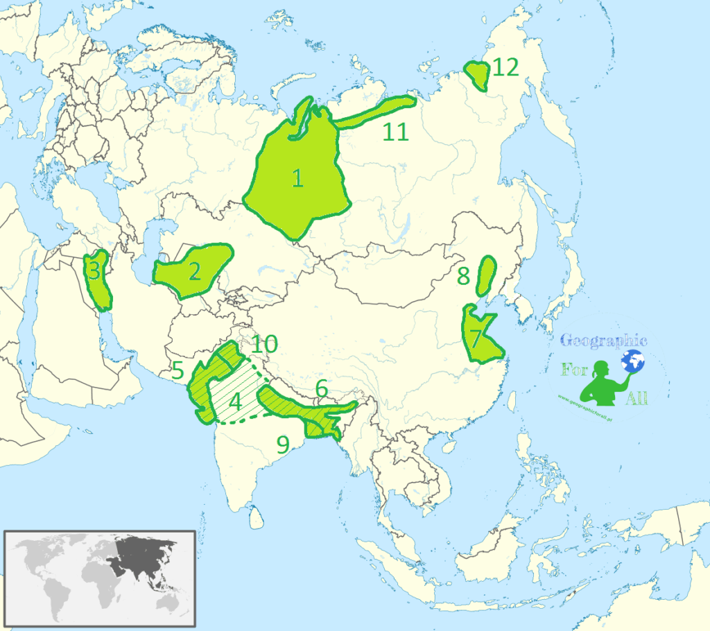
Asia
- West Siberian Plain
- Turan Depression / Turan Lowland / Turanian Basin
- Mesopotamian Plain
- Indo-Gangetic Plain / Indus-Ganga Plain / North Indian River Plain (Indus River Plain + Ganges River Plain and Brahmaputra River Plain + Bengal Lowland + Punjab Plain)
- Indu Plain
- Ganges and Brahmaputra Plain
- North China Plain
- Northeast China Plain / Manchurian Plain
- Bengal Lowland
- Punjab Plain
- North Siberian Lowland / Taymyr Lowland
- Kolyma Lowland
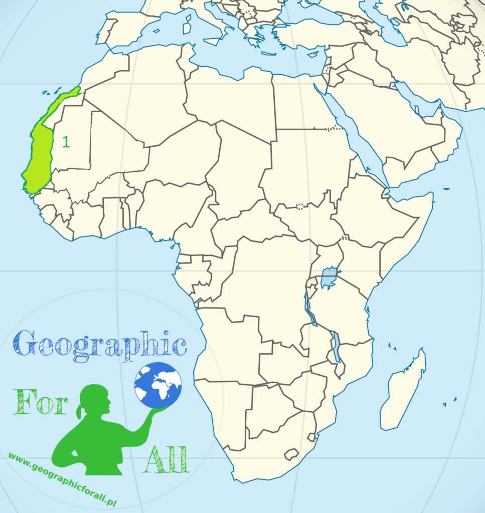
Africa
- West African Lowland / Senegal Lowland
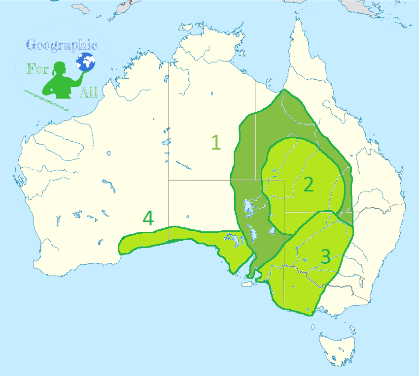
Australia
- Central (Australian) Lowlands (all lowlands except Nullarbor Plain)
- Great Artesian Basin
- Murray–Darling Basin
- Nullarbor Plain
North America
- Hudson Bay Lowlands
- Nizina Zatokowa
- Atlantic coastal plain
- Great Plains*
- Great Lakes-Saint Lawrence Lowlands

South America
- Orinoco Basin
- Amazon Basin
- Río de la Plata Basin / River Plate Basin
- Guiana Lowland

0 Comments for “Physical map of the world – lowlands”